
Table of Contents
- Why Drone Technology Is Changing Home Inspections
- Safety Benefits for Inspectors and Homeowners
- How Home Inspectors Use Drones to Assess Property Condition
- Thermal Imaging for Home Insulation and Energy Efficiency
- Accuracy, Detail, and What Drones Actually Reveal
- Understanding Drone Roof Inspection Cost and Value
- Legal, Privacy, and Operational Considerations
- Conclusion
- Frequently Asked Questions
Last Updated: September 28, 2026
Why Drone Technology Is Changing Home Inspections
Drone home inspections represent a fundamental shift in how property condition assessments are conducted. At Zenith Property Inspections, we’ve seen firsthand how unmanned aerial vehicles combined with thermal imaging technology deliver insights that traditional ground-level inspections simply cannot capture. The shift isn’t just about better photos, it’s about accessing areas that were previously difficult, dangerous, or impossible to evaluate thoroughly.
Traditional inspections using ladders and binoculars create blind spots on steep roofs, multi-story structures, and hard-to-reach gutters. Drone home inspections eliminate these blind spots with high-resolution imagery and thermal data from angles and heights that ground-based inspectors cannot safely reach.
Drone home inspections have evolved from novelty to standard practice, expected by informed buyers and sellers who understand the value of comprehensive property documentation.
Safety Benefits for Inspectors and Homeowners
The primary advantage of drone home inspections is eliminating fall risk by removing the need for inspectors to climb ladders and work at heights on steep roofs and multi-story structures.
Traditional roof inspections require inspectors to physically access steep pitches where one misstep creates serious injury risk. Drones eliminate this hazard entirely, allowing inspectors to capture roof data from ground level while reducing liability and providing homeowners peace of mind.
Drone technology also protects homeowners by eliminating the need to access dangerous roof areas, resulting in faster, safer inspections for properties with steep pitches, complex features, or significant height.
Inspections that once required 30-45 minutes of ladder work can be completed faster using aerial assessment, and the drone captures consistent imagery without the physical fatigue that affects inspector focus during traditional climbs.
How Home Inspectors Use Drones to Assess Property Condition
Drone home inspections follow a structured flight path covering the roof, exterior walls, gutters, chimneys, vents, and other elevated features requiring assessment.
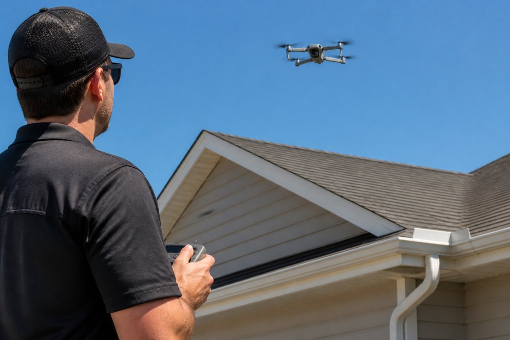
High-resolution cameras capture individual shingles and flashing details with clarity binoculars cannot match. Real-time monitoring allows inspectors to identify problems during flight and adjust the path for closer looks, an advantage over ladder-based inspections relying on memory and notes.
Drone imagery reveals structural problems like sagging roof lines, misaligned gutters, water damage, missing shingles, and deteriorated flashing. Inspectors document these with timestamped, geotagged images in the inspection report.
Gutter issues like clogs, sagging, and separation are visible from above in ways ground-level inspection cannot reveal, helping homeowners understand drainage condition without inspector access risk.
Thermal Imaging for Home Insulation and Energy Efficiency
Thermal imaging reveals heat loss patterns invisible to the human eye, detecting temperature variations across roof surfaces, walls, and penetrations like vents and chimneys.
Thermal images show where insulation is missing, compressed, or ineffective. Cold spots indicate areas where conditioned air escapes or outside temperatures penetrate the building envelope, identifying exactly where energy dollars are wasted.
Thermal imaging reveals moisture problems before they become visible as stains or damage. Wet insulation shows different temperatures than dry insulation, identifying roof leaks and moisture intrusion early, reducing remediation costs and preventing structural damage.
Visual imagery combined with thermal data creates a complete picture of property condition. A roof may look fine visually but show significant heat loss in thermal imaging, indicating insulation failure, information traditional inspections miss.
Accuracy, Detail, and What Drones Actually Reveal
High-resolution drone imagery captures details that change property assessment. Inspectors can count missing shingles, identify deterioration, and document exact damage locations.
This detail moves reports from general observations to specific, measurable findings, for example, documenting exact missing shingle locations with coordinates and underlying condition photos.
Digital documentation from drone home inspections creates a baseline record of property condition. Timestamped, geotagged images protect both buyer and inspector by creating an objective, undisputable record.
Drones cannot see inside walls, under roofing material, behind finishes, or assess foundations and subsurface issues. Drone home inspections complement traditional inspections; they don’t replace ground-level assessment, interior evaluation, and structural analysis.
Accuracy comes from systematic coverage, drones photograph every inch of roof surface, whereas ladder-based inspectors cover only safely accessible areas, resulting in fewer missed problems.
Understanding Drone Roof Inspection Cost and Value
Whether drone home inspections justify their cost depends on property type, what you need to understand about condition, and how you’ll use the data.
Single-story homes with accessible roofs may need only traditional inspection. Multi-story homes, complex roofs, or steep pitches benefit from drone home inspections’ superior assessment capabilities. Investors benefit from systematic documentation across multiple properties. Luxury buyers and those purchasing properties with known roof issues gain significant value from detailed thermal and visual data.
How Drone Inspection Data Is Delivered and Used
How inspection data is organized and delivered affects its practical value. Drone home inspections generate significantly more data than traditional inspections.
Digital Report Formats: Cloud-based platforms allow viewing high-resolution images, zooming into roof areas, and accessing thermal data through interactive interfaces. Geotagged images show exact photo locations, useful when discussing repairs with contractors.
Image Organization and Accessibility: Professional reports organize 150-400+ images by roof section and feature type (gutters, flashing, vents, chimneys), allowing quick location of relevant images. Some platforms allow custom collections and annotations for contractor review.
3D Models and Orthomosaic Maps: Advanced services provide orthomosaic maps, stitched aerial photographs creating a single high-resolution roof image from above, allowing distance measurement and damage pattern identification. 3D models enable viewing from any angle, useful for complex roof geometry. These digital reconstructions provide a foundation for more immersive visual storytelling, which can be further enhanced by integrating professional aerial videography services to capture the property context.
Thermal Data Presentation: Thermal images overlay visual images with color scales indicating temperature variations. Quality reports explain what patterns mean, cold spots indicate insulation failure or air leakage, warm spots may indicate moisture.
Cost-Benefit Analysis by Property Type
The real cost comparison is inspection cost versus the cost of discovering problems after closing. A thorough drone home inspection identifying roof problems before purchase is worth substantially more than discovering them after ownership.
Legal, Privacy, and Operational Considerations
Drone operations are governed by FAA regulations requiring remote pilot certification for commercial use. Any inspector conducting drone home inspections must hold a Part 107 Remote Pilot Certificate.
Weather-Specific Operational Limits
Weather conditions directly impact whether a drone inspection can be conducted safely and whether the resulting imagery will be usable. Understanding these thresholds helps homeowners plan inspections and understand why rescheduling may be necessary.
Battery Life and Coverage Planning
Battery life is a practical operational constraint that affects inspection scope and duration. Most commercial drones provide 20-30 minutes of flight time per battery under ideal conditions (calm weather, moderate temperature, level flight). Real-world conditions reduce this to 15-25 minutes per battery. For a typical residential property, one battery provides sufficient flight time to capture roof, gutters, exterior walls, and chimneys systematically.
Liability Insurance and Regulatory Compliance
Not all drone operators are certified for commercial inspection work. Verify that your inspector holds an FAA Part 107 Remote Pilot Certificate and carries appropriate liability insurance covering drone operations. An uncertified operator exposes you to liability and may produce data that’s inadmissible in disputes. Professional inspection companies carry general liability insurance that specifically covers drone operations, typically in the $1 million to $2 million range.
Conclusion
Drone home inspections represent a genuine advancement in property assessment technology, combining safety, accuracy, and documentation capabilities that traditional inspections cannot match. The combination of high-resolution imagery, thermal data, and systematic coverage identifies problems early and creates objective records that protect buyers, sellers, and investors.
|
Assessment Method |
Coverage |
Safety |
Documentation |
Thermal Data |
|---|---|---|---|---|
|
Traditional Inspection |
Limited to accessible areas |
Ladder/height risk |
Photos + notes |
No |
|
Drone Home Inspection |
Systematic full coverage |
Ground-level operation |
High-resolution geotagged images |
Yes |
|
Hybrid Approach |
Complete interior + exterior |
Minimized risk |
Comprehensive documentation |
Yes |
Frequently Asked Questions
Is a drone roof inspection worth it for a first-time home buyer?
Drone roof inspections provide high-resolution aerial imagery that reveals damage, wear, and structural issues invisible from ground level. For first-time buyers, this clarity reduces surprises after closing and helps you understand repair costs upfront. The added investment typically pays for itself by identifying costly problems early—missing a roof leak or chimney damage can cost thousands in repairs. Your inspector can explain findings in detail, so you’re not decoding a technical report alone.
Can drone technology detect mold, structural issues, or problems a physical inspection might miss?
Drones excel at accessing hard-to-reach areas: high roofs, gutters, soffits, and chimney flashing where moisture and damage often hide first. Thermal imaging detects temperature variations that signal insulation gaps, air leaks, or moisture intrusion behind walls—clues that standard visual inspection alone cannot catch. That said, drones cannot see inside walls or under flooring. A thorough inspection combines drone imagery with hands-on assessment of foundation, plumbing, and electrical systems to catch issues across the full property.
What are the main limitations of drone inspections?
Weather conditions—wind, rain, and low visibility—can ground drones or reduce image quality. Drones cannot inspect interior systems like HVAC ducts, plumbing behind walls, or electrical panels. They also cannot diagnose the cause of problems, only document what’s visible. Heavy cloud cover or dense tree canopy may block aerial access to certain roof sections. A certified inspector uses drones as one tool alongside traditional methods to deliver a complete picture of your property’s condition.
How does thermal imaging reveal insulation problems in my home?
Thermal cameras detect heat loss and air leaks by showing temperature differences across your home’s exterior. Cold spots on walls, ceilings, or around windows indicate where insulation is missing or compromised, or where air is escaping. This data helps you prioritize energy-efficiency upgrades and understand why certain rooms feel drafty. Thermal imaging is especially valuable for older homes where insulation may have settled or degraded over decades, directly impacting heating and cooling costs.
Learn more about how drone technology improves property assessment:
FAA Part 107 Remote Pilot Certification requirements
InterNACHI Standards of Practice for property inspectors
Thermal imaging applications in building science and energy efficiency